|
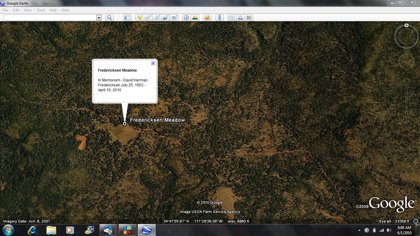
This observing site was previously known as Five Mile Meadow and was recently renamed in honor of David Fredericksen. For those of you who might not have made this kind of trip before, here are several important points:
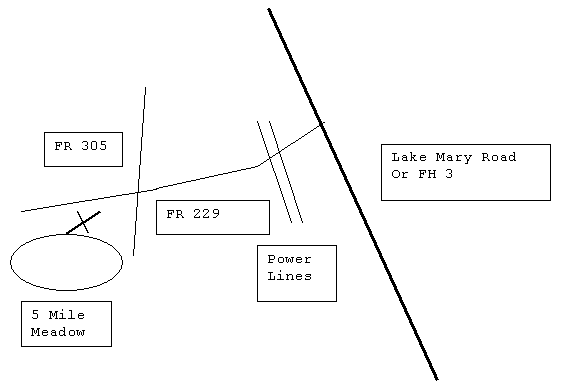
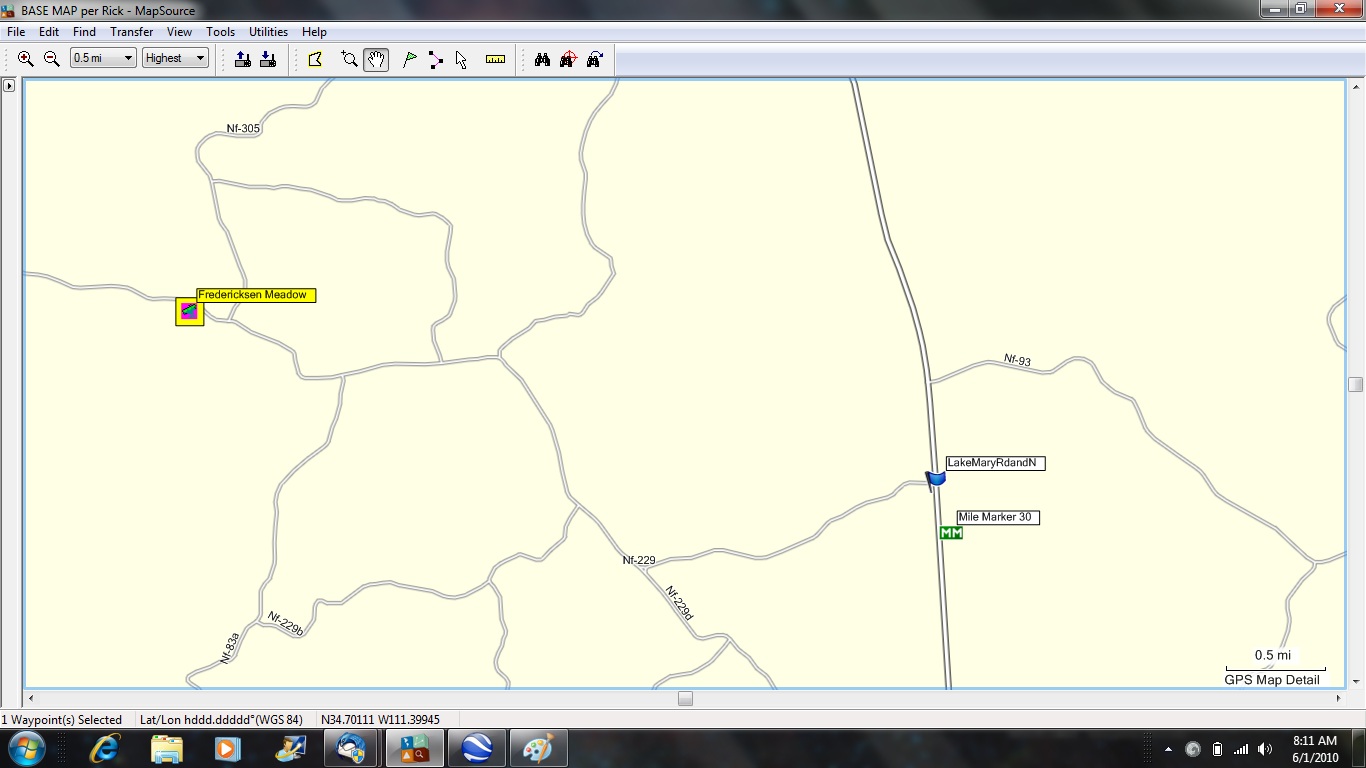
From central Phoenix or the west side, take I-17 north to the Verde Valley turnoff and go east on Highway 260, the General Crook Trail, for about 30 miles east of the town of Camp Verde. The road ends in a “T” with Highway 87. Turn left (generally north) and drive about 12 miles, through the little town of Clint’s Well. This is the gas station, restaurant and ranger station on your left. If your trek originates in the East Valley, just head out of town on Highway 87 (Beeline). After you pass through Clint’s Well, there is a left turn lane that will allow you to turn left onto Forest Highway 3, aka Lake Mary Road. As you drive north on Lake Mary Road you will pass the Happy Jack RV park on the left and pass through a large area of trees where there has been a forest fire. After about 12 miles on Lake Mary Road, look for mile marker 301 and slow down to look for a dirt road on your left. The sign for this road says “Bar D Ranch”. You will know you are on the correct forestry road by two brown signs, a small one with number 229 and another, larger, with Bar D Ranch distance. You will pass under high voltage power lines at about 1.5 miles and there is a cattle guard at about 3 miles. If you make no turns off the well maintained road then you will reach a cross road marked 305, on a brown sign. The meadow is straight ahead, past the cross road and just to the left. The meadow is elongated in an easterly direction and, if you stay on the original road 229 it will take you just to the north side, where it is best to set up. About 1/10 of a mile past the cross road is an opening in the trees to your left that leads to an opening where you can set up. I called this site “Five Mile Meadow” because it is about 5 miles from the pavement on the forestry road.
|
|||||||||||
|
|
|||||||||||
|
|
|||||||||||
|
|
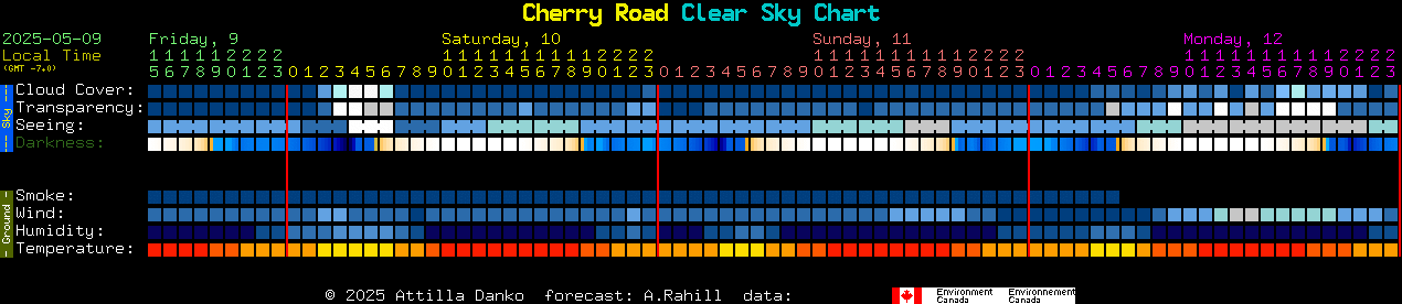
(Nearest Clear Sky Clock)